Maps: Difference between revisions
From WindsportAtlanta.com: Wiki
No edit summary |
|||
| (2 intermediate revisions by the same user not shown) | |||
| Line 1: | Line 1: | ||
[[Category: | [[Category:Windsurfing Sites]] | ||
== External Sites == | == External Sites == | ||
* [http:// | * [http://maps.google.com/maps/ms?ie=UTF8&oe=UTF-8&hl=en&t=k&om=1&msa=0&msid=100870502636244485930.00000111c2642afd122dd&z=10&ll=28.486798,-80.68634&spn=0.649376,0.806122 East Central Florida Windsurfers] | ||
* [http://uswindsurfing.org/waterspotr/ US Windsurfing WaterSpotr] is an app of the [http://uswindsurfing.org/ US Windsurfing Association]. It’s designed to help windsurfers and other watersports enthusiasts locate launch sites in their vicinity and connect with others. It’s simply more fun when you’re not alone! | |||
Latest revision as of 12:56, 29 March 2018
External Sites
- East Central Florida Windsurfers
- US Windsurfing WaterSpotr is an app of the US Windsurfing Association. It’s designed to help windsurfers and other watersports enthusiasts locate launch sites in their vicinity and connect with others. It’s simply more fun when you’re not alone!
Pages in category "Maps"
The following 15 pages are in this category, out of 15 total.
F
Media in category "Maps"
The following 3 files are in this category, out of 3 total.
 LakeLanierMapBook 2005-09-19.pdf 0 × 0; 9.56 MB
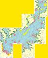 Lanier-contour.jpg 3,136 × 3,799; 1.82 MB
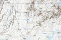 Nw-ga-mtns-topo.jpg 1,237 × 816; 306 KB

