Lake Lanier Underwater Contour Maps
From WindsportAtlanta.com: Wiki
The maps are from the Lake Lanier Map Book. They show geographic contours, and unlike many such maps, show contours under the lake. This is especially helpful when the lake is at lower levels as obstructions appear in what might otherwise appear to be very open water.
- Lake Lanier Contour Maps
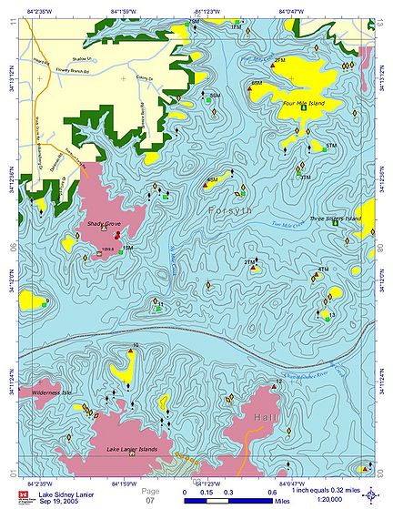
West of Two Mile.jpg Two Mile Creek Park and Westward
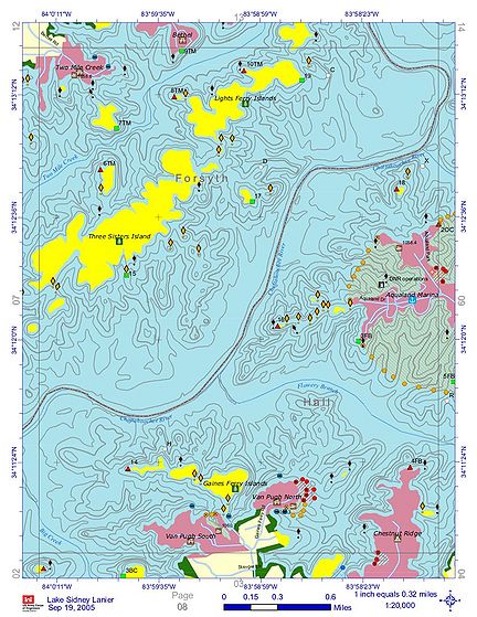
Van Pugh Aqualand.jpg Van Pugh to Aqualand
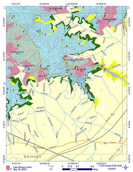
Holiday VP South.jpg Van Pugh South to Holiday Harbor


