File list
This special page shows all uploaded files.
| Date | Name | Thumbnail | Size | User | Description | Versions |
|---|---|---|---|---|---|---|
| 23:07, 2 January 2012 | M-en-recentchanges.png (file) |  |
73 KB | Webguy | 1 | |
| 23:08, 2 January 2012 | PD-Help icon.png (file) | 21 KB | Webguy | 1 | ||
| 23:08, 2 January 2012 | Wiki.png (file) |  |
30 KB | Webguy | 1 | |
| 23:10, 2 January 2012 | M-en-sidebar.png (file) |  |
18 KB | Webguy | 1 | |
| 23:10, 2 January 2012 | M-en-userlinks.png (file) | 10 KB | Webguy | 1 | ||
| 23:21, 2 January 2012 | Heckert GNU white.png (file) |  |
63 KB | Webguy | 1 | |
| 23:22, 2 January 2012 | Tools.png (file) |  |
16 KB | Webguy | 1 | |
| 23:22, 2 January 2012 | Attention niels epting.png (file) |  |
4 KB | Webguy | 1 | |
| 23:22, 2 January 2012 | PD-icon.png (file) | 9 KB | Webguy | 1 | ||
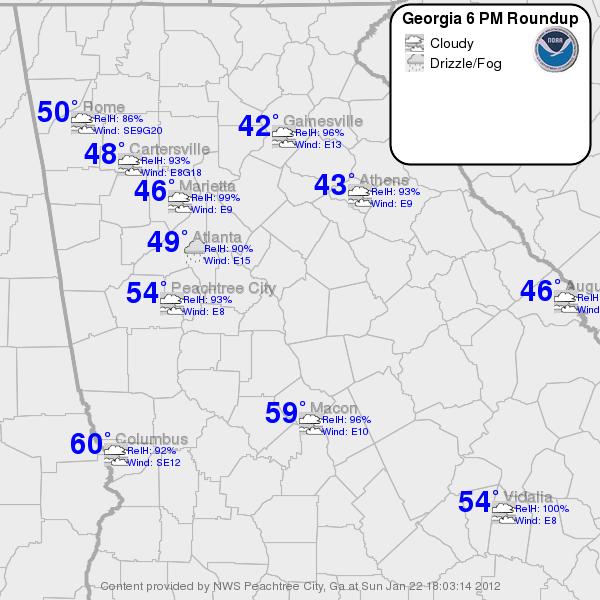
| 21:43, 22 January 2012 | Wedge curconds.jpg (file) |  |
54 KB | Webguy | Wedge conditions on Jan 22, 2012 | 1 |
| 22:10, 22 January 2012 | Wedge atl 1 22 12.jpg (file) |  |
126 KB | Webguy | Southeast temps during a wedge | 1 |
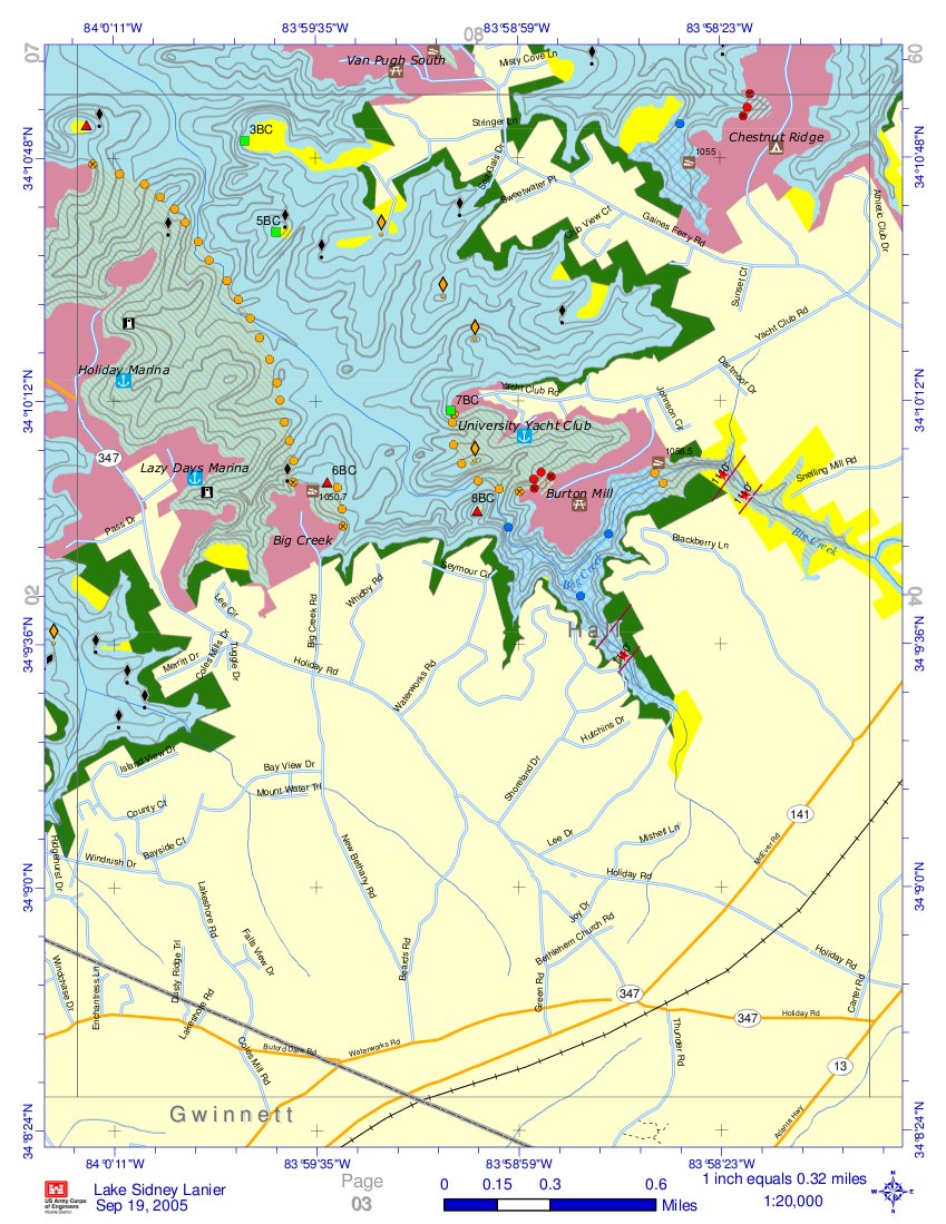
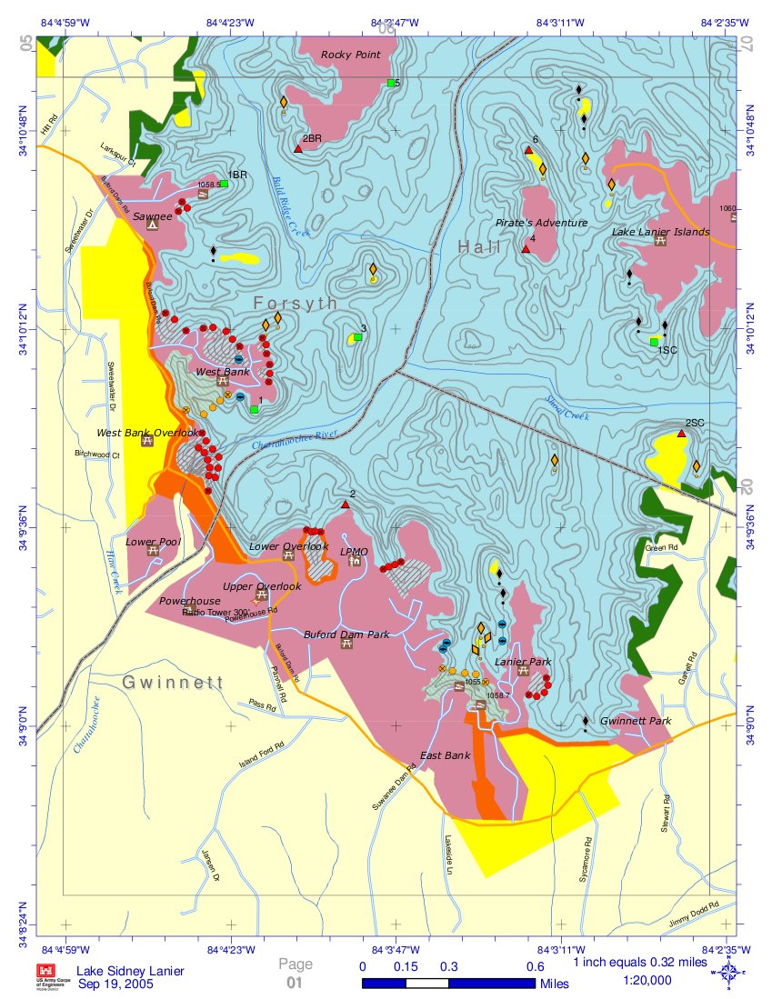
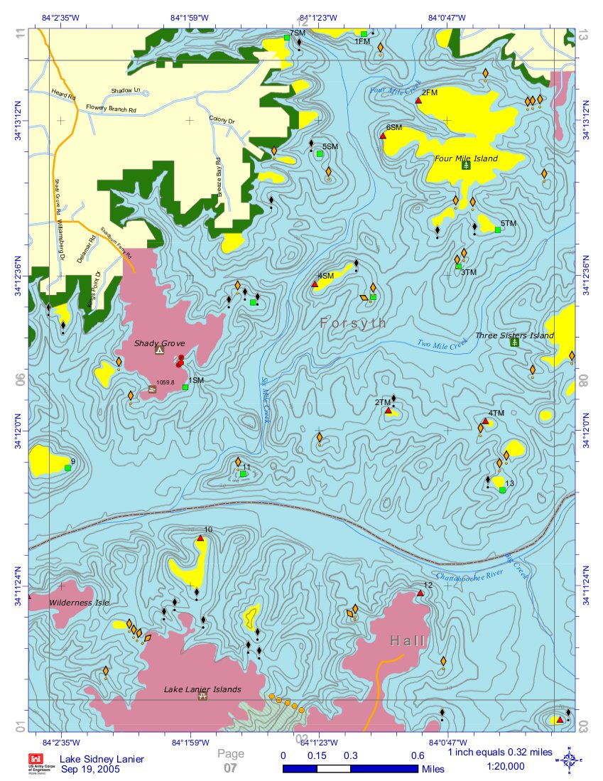
| 01:23, 26 January 2012 | Holiday VP South.jpg (file) |  |
228 KB | Webguy | Contour Maps for Lake Lanier. Helpful for understanding potential hazards especially during periods of lower lake levels. | 1 |
| 01:23, 26 January 2012 | Van Pugh Aqualand.jpg (file) |  |
257 KB | Webguy | Contour Maps for Lake Lanier. Helpful for understanding potential hazards especially during periods of lower lake levels. | 1 |
| 01:23, 26 January 2012 | West Bank.jpg (file) |  |
223 KB | Webguy | Contour Maps for Lake Lanier. Helpful for understanding potential hazards especially during periods of lower lake levels. | 1 |
| 01:23, 26 January 2012 | West of Two Mile.jpg (file) |  |
242 KB | Webguy | Contour Maps for Lake Lanier. Helpful for understanding potential hazards especially during periods of lower lake levels. | 1 |
| 01:23, 26 January 2012 | Vanns Tavern.jpg (file) |  |
210 KB | Webguy | Contour Maps for Lake Lanier. Helpful for understanding potential hazards especially during periods of lower lake levels. | 1 |
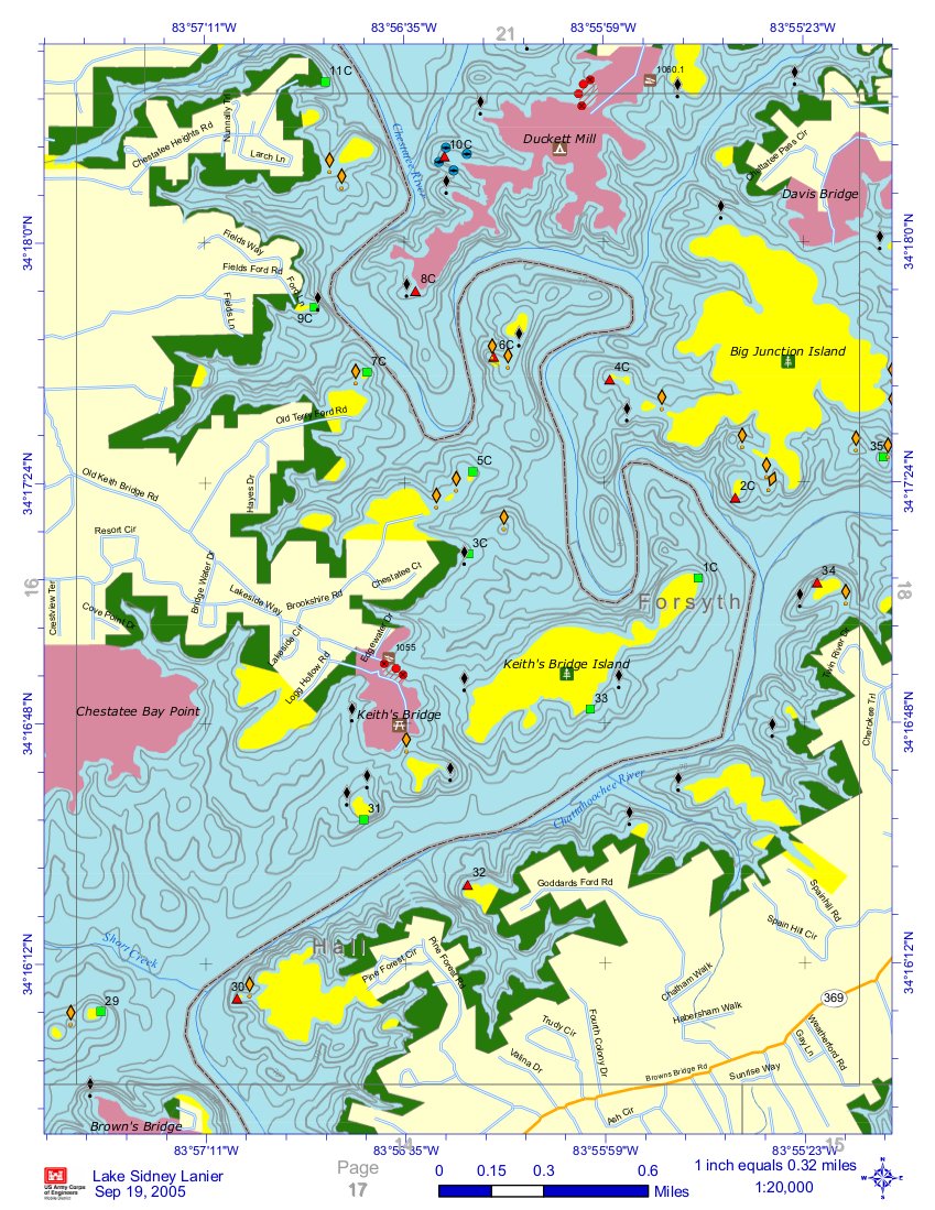
| 01:25, 26 January 2012 | Keith's Bridge.jpg (file) |  |
265 KB | Webguy | Contour Maps for Lake Lanier. Helpful for understanding potential hazards especially during periods of lower lake levels. | 1 |
| 01:25, 26 January 2012 | LLSC.jpg (file) |  |
254 KB | Webguy | Contour Maps for Lake Lanier. Helpful for understanding potential hazards especially during periods of lower lake levels. | 1 |
| 01:25, 26 January 2012 | MtView Sunrise Old Federal.jpg (file) |  |
278 KB | Webguy | Contour Maps for Lake Lanier. Helpful for understanding potential hazards especially during periods of lower lake levels. | 1 |
| 01:25, 26 January 2012 | Tidwell.jpg (file) |  |
262 KB | Webguy | Contour Maps for Lake Lanier. Helpful for understanding potential hazards especially during periods of lower lake levels. | 1 |
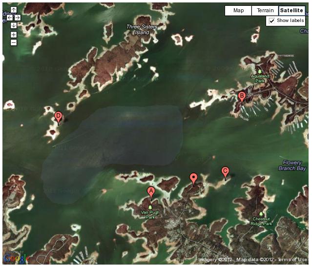
| 12:25, 30 January 2012 | Vp-wind.jpg (file) |  |
57 KB | Webguy | Shaded area indicates likely area of better wind if the breeze is from the west. | 1 |
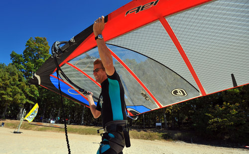
| 11:02, 6 February 2012 | IMG 0451a.jpg (file) |  |
44 KB | Webguy | Al sailing at Little Ridge. Photo by Chris Voith | 1 |
| 18:46, 15 June 2012 | County dock launch 1.jpg (file) |  |
39 KB | Webguy | 1 | |
| 18:48, 15 June 2012 | Shands bridge ramp 3.jpg (file) |  |
30 KB | Webguy | 1 | |
| 18:48, 15 June 2012 | Shands bridge ramp 4.jpg (file) |  |
28 KB | Webguy | 1 | |
| 18:48, 15 June 2012 | Spring park green cove springs.jpg (file) |  |
39 KB | Webguy | 1 | |
| 18:48, 15 June 2012 | Williams Park launch 1.jpg (file) |  |
39 KB | Webguy | 1 | |
| 18:48, 15 June 2012 | Williams Park launch 2.jpg (file) |  |
39 KB | Webguy | 1 | |
| 12:41, 30 July 2012 | Acworth randy.jpg (file) |  |
12 KB | Webguy | Randy Falkenberg captured on Lake Acworth during a local news story | 1 |
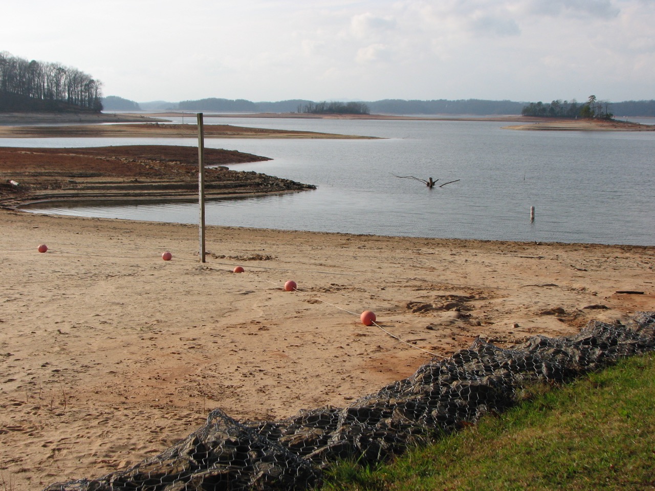
| 15:58, 21 March 2013 | Mel returning to base camp.jpg (file) |  |
28 KB | Webguy | Mel returning to base camp. See how exposed the clay was on Nov 2006. This is off shore Old Federal. Usually at full pond, it is underwater | 1 |
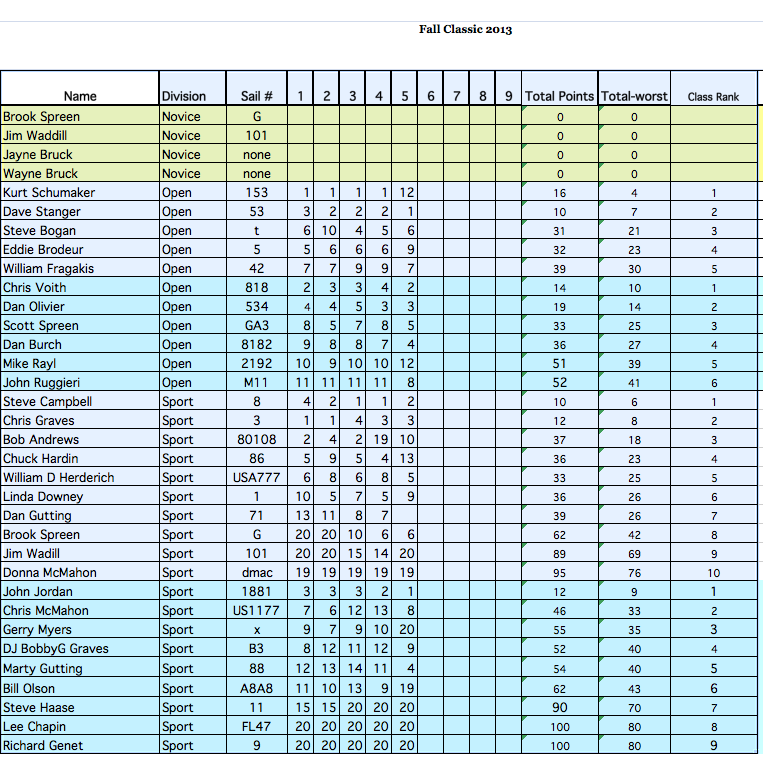
| 09:26, 26 November 2013 | Fall classic 2013 results.png (file) |  |
141 KB | Webguy | Results from the 35th Annual Fall Classic. | 1 |
| 10:50, 16 May 2014 | Craigslist01.jpg (file) |  |
83 KB | Webguy | Ad from Craigslist | 1 |
| 10:51, 16 May 2014 | Craigslist02.jpg (file) |  |
100 KB | Webguy | Ad from Craigslist. Cheap isn't always good value. | 1 |
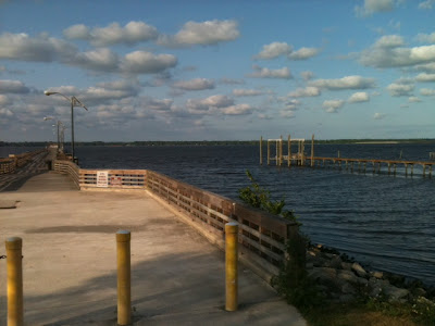
| 18:43, 10 February 2015 | Van-pugh-june-session-launch.jpg (file) |  |
400 KB | Webguy | Windsurfing launch Van Pugh, Lake Lanier, Georgia. Wind: W 16-26mph 88/82F June, 2013 | 1 |
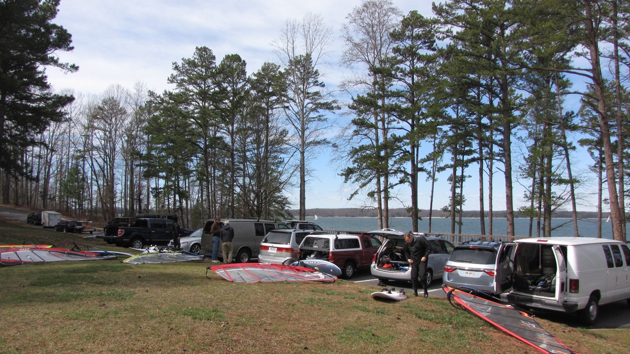
| 18:43, 10 February 2015 | Van-pugh-rigging-area-windy-day.jpg (file) |  |
412 KB | Webguy | Van Pugh Park,Lake Lanier, Georgia windsurf rigging area | 1 |
| 18:43, 10 February 2015 | Van-pugh-rigging-early-march.jpg (file) |  |
541 KB | Webguy | Early March windsurfing at Van Pugh | 1 |
| 18:43, 10 February 2015 | Mid-january-van-pugh.jpg (file) |  |
368 KB | Webguy | Mid January Day at Van Pugh, 2015. | 1 |
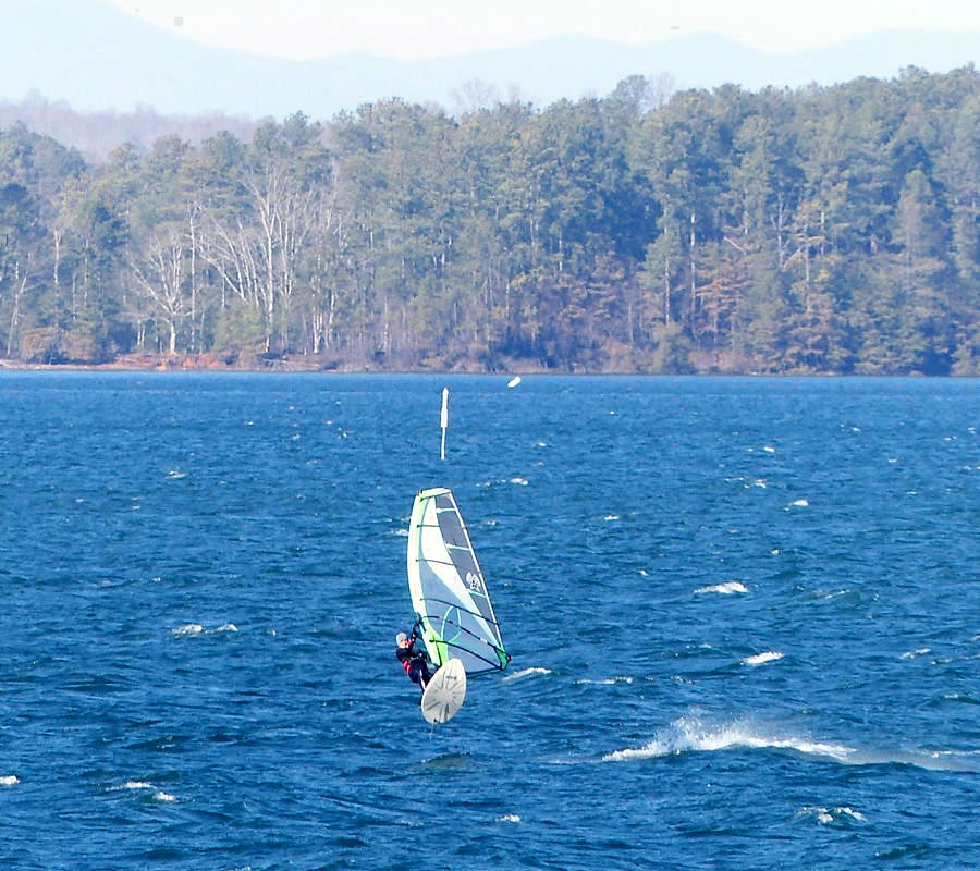
| 18:43, 10 February 2015 | Scott-spreen-upwind-of-van-pugh-lake-lanier.jpg (file) |  |
453 KB | Webguy | Barrett Walker photo of Scott Spreen just above Van Pugh launch on Lake Lanier | 1 |
| 18:43, 10 February 2015 | Kiting-old-federal-park-full-pond.jpg (file) |  |
308 KB | Webguy | Kiters at Old Federal Park with Lake Lanier at full pool. 2014 | 1 |
| 18:43, 10 February 2015 | Old-federal-park-drought-2007.jpg (file) |  |
383 KB | Webguy | Old Federal Park, Lake Lanier during drought 2007 | 1 |
| 22:31, 10 February 2015 | IMG 3496 2.jpg (file) |  |
337 KB | Webguy | Dressing for warmth is important in the winter. Bill Austin is all covered but warm and safe. | 1 |
| 22:31, 10 February 2015 | IMG 3542.jpg (file) |  |
219 KB | Webguy | Gene Mathis shows the thrill of speed. | 1 |
| 22:37, 10 February 2015 | P1040507 2a.jpg (file) |  |
152 KB | Webguy | Marek Skupien soars over Lake Lanier on a crisp January day in 2015. | 1 |
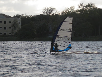
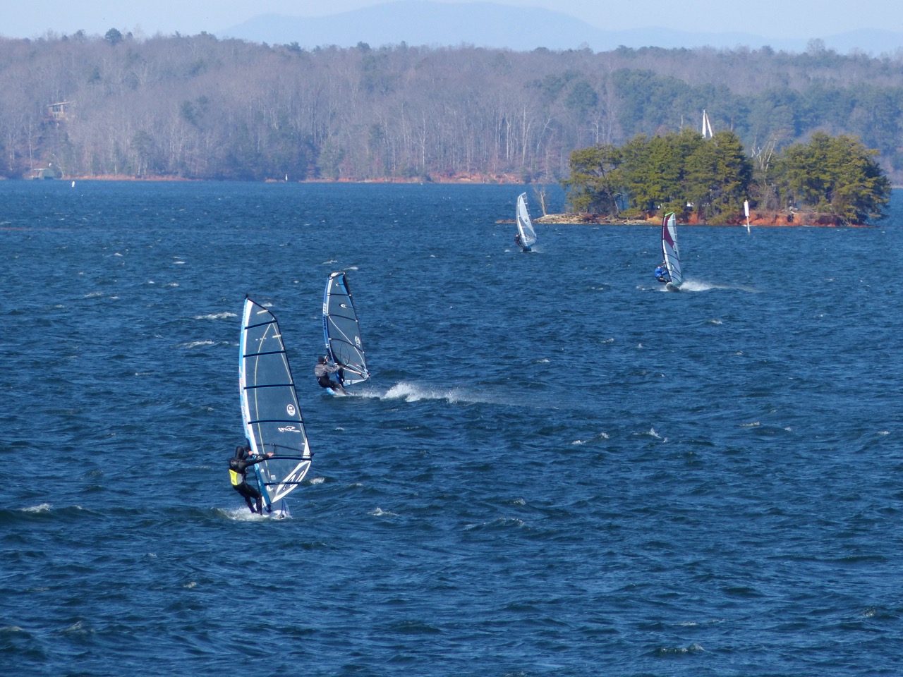
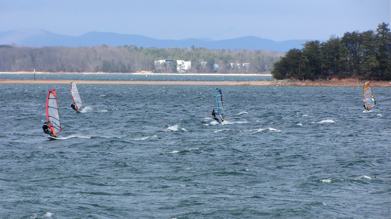
| 23:01, 10 February 2015 | IMG 3528.jpg (file) |  |
340 KB | Webguy | Windsurfers at Van Pugh Park on Lake Lanier | 1 |
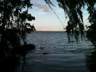
| 09:43, 5 July 2015 | Sunrise-cove-lake-lanier.jpeg (file) |  |
2.16 MB | Webguy | Sunrise Cove, Lake Lanier, facing SW. Photo by Barrett Walker | 1 |
| 13:03, 29 October 2015 | Fall classic 2015 results.png (file) |  |
0 bytes | Webguy | Placings and results for 37th Annual Fall Classic. The Atlanta Boardsailing Club and the Lake Lanier Sailing Club. Oct 17-18, 2015 | 1 |
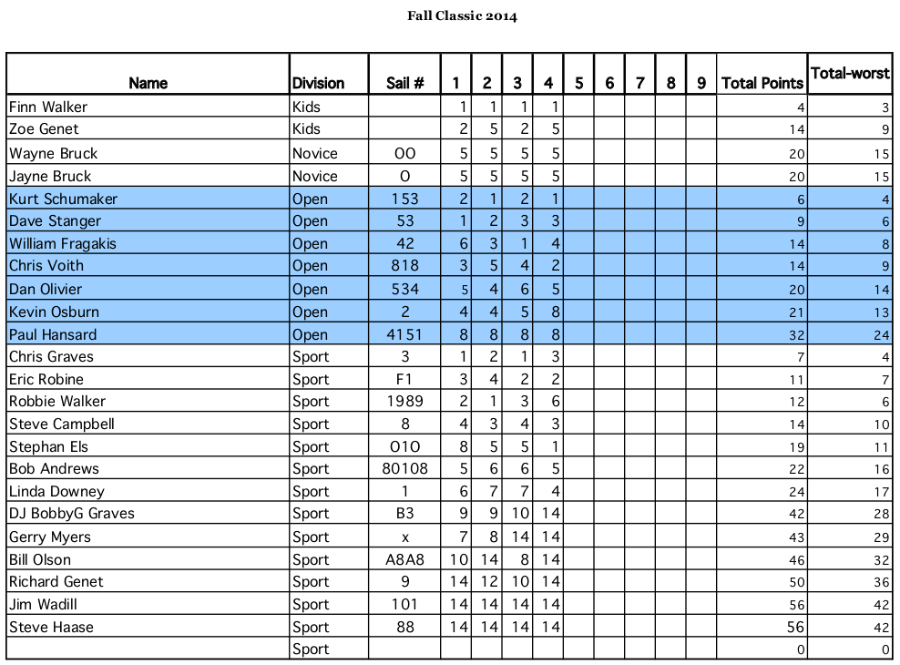
| 14:12, 29 October 2015 | Fall classic 2014 results.png (file) |  |
103 KB | Webguy | Placings and results for 36th Annual Fall Classic. The Atlanta Boardsailing Club and the Lake Lanier Sailing Club. Oct 18-19, 2014 | 1 |
| 14:27, 29 October 2015 | Fall classic 2014 bing1.jpg (file) |  |
99 KB | Webguy | 2014 Fall Classic captured on Bing Maps | 1 |
| 14:33, 29 October 2015 | Fall classic 2014 bing.jpg (file) |  |
0 bytes | Webguy | Racer rounding mark at 2014 Fall Classic captured on Bing Maps | 1 |
| 18:02, 29 October 2015 | Fallclassic.1017 bs1.JPG (file) |  |
75 KB | Webguy | Chris Voith -source ajc.com | 1 |