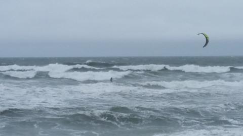
Marcel has sent an update from the Outer Banks where wind and storm waves from Hurricane Maria are lashing the coast. An evacuation order has been issued for areas south of Nags Head for Ocracoke and Hatteras Island as follows:
Dare County is now under a Tropical Storm Warning.
We continue to monitor the progress of Hurricane Maria as it moves northward in the Atlantic and we ask that you do the same. Areas to the south of us, Ocracoke and Hatteras Islands, are now under a mandatory evacuation order for all visitors as access is likely to be compromised by blowing sand and ocean over-wash along NC 12.
No evacuation order is expected for areas north of Oregon Inlet.
—
Barrett


Barrett are you there now? I was thinking of driving up late Wednesday to stay in Frisco but if im not allowed on island, where can I sail in Nags Head?
MIght be early. They are expecting mild flooding today: https://twitter.com/DareCountyGovt/status/912425161680441344
https://twitter.com/darecountygovt
Disclaimer: I'm just an idiot on the internet sitting 600 miles away.
One of the places to launch.
Harvey Soundside Park
6912 S Croatan Hwy, Nags Head, NC 27959
(252) 441-5508
https://goo.gl/maps/BVZ4MKwckDT2
Marcel
Launch in Nags Head here:
https://www.google.com/maps/place/35%C2%B057'10.1%22N+75%C2%B037'56.7%22W/@35.952813,-75.6338537,463m/data=!3m2!1e3!4b1!4m13!1m6!3m5!1s0x89a4e39b3da4206d:0xab5d620c15ccca5e!2sNags+Head!8m2!3d35.9624046!4d-75.6339017!3m5!1s0x0:0x0!7e2!8m2!3d35.9528133!4d-75.6324277?hl=en[/
LPT: The share icon on Google maps gives you a dialogue box which gives you the option to short the url
https://goo.gl/maps/2Dgoz45kmy22
I agree that Harvey Soundside Park is generally the best public launch site. There is a roofed pavilion, bathroom, and grassy area for rigging. It's off S. Croatan Hwy., next to Millers Waterfront Restaurant. As Marcel pointed out, it's location is marked on Google Maps.
Our 2 week stay in Nags Head begins on Sat. Oct. 7th.
Barrett
https://www.wunderground.com/cat6/winds-and-storm-surge-rising-north-carolina-marias-brush